Historical Background
The roots of geophysics traced back to ancient civilizations, And observations of natural phenomena laid the foundation for our understanding of the Earth. However, modern geophysics as a scientific discipline emerged in the late 19th and early 20th centuries with the development of instruments and techniques to measure and analyze physical properties such as gravity, magnetism, and seismic waves.
Fundamental Concepts of Geophysics
Gravity is a fundamental force that governs the motion of objects on Earth and in space. In geophysics, gravity measurements used to map variations in the density of subsurface materials, providing insights into the structure of the Earth’s interior.
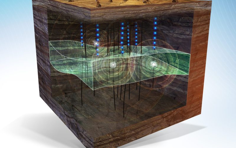
Seismic waves are vibrations that travel through the Earth in response to earthquakes or other sources of energy. By analyzing the speed, direction, and amplitude of seismic waves, geophysicists can infer the properties of subsurface rocks and identify potential hazards such as faults and underground reservoirs.
Electromagnetic methods involve the use of electromagnetic fields to probe the electrical conductivity and magnetic properties of the Earth’s crust. These methods commonly used in mineral exploration, groundwater mapping, and environmental studies.
Magnetic Science fields produced by the movement of electrically charged particles within the Earth’s core and crust. Geophysicists use magnetic surveys to map variations in the Earth’s magnetic field, which can reveal information about the distribution of magnetic minerals and geological structures.
Geophysics
Geophysics has numerous applications across various industries and scientific disciplines. In resource exploration, geophysical methods used to locate and characterize oil and gas reservoirs, mineral deposits, and groundwater resources. The environmental studies, geophysics is used to assess soil and groundwater contamination, monitor natural hazards earthquakes and volcanoes, study the effects of climate change on the Earth’s surface and atmosphere.
Technological Advances in Geophysical Methods

Advances in instrumentation and technology have revolutionized the field of geophysics in recent decades. Modern geophysical instruments capable of collecting vast amounts of data with high precision and resolution, allowing geophysicists to study the Earth’s subsurface in unprecedented detail. Satellite technology has enabled remote sensing and monitoring of the Earth’s surface and atmosphere, while computer modeling and simulations have enhanced our ability to interpret complex geophysical data and visualize geological processes.
Challenges and Limitations
Despite its many applications and advancements, geophysics still faces several challenges and limitations. Interpreting geophysical data requires expertise and experience, and uncertainties in measurements and modeling can affect the accuracy and reliability of results. Accessing remote or hostile environments, such as deep ocean basins or polar regions, can also be challenging and expensive.
Environmental Geophysics
In the oil and gas industry, geophysical methods such as seismic imaging and electromagnetic surveys used to identify potential hydrocarbon reservoirs and optimize drilling operations. In mining, geophysics is used to locate and delineate mineral deposits, assess the stability of mine sites, and monitor environmental impacts.. Environmental geophysics focuses on the application of geophysical methods to address environmental challenges and monitor natural resources. In soil science, geophysical techniques such as electrical resistivity imaging and ground-penetrating radar used to study soil properties, map soil moisture content, and monitor soil erosion and compaction. The climate science, geophysics is used to study the Earth’s atmosphere and oceans, monitor changes in temperature and sea level, and assess the impact of climate change on ecosystems and human societies.
Geophysics in Natural Disaster Management
Geophysics plays a crucial role in natural disaster management, helping to predict, monitor, and mitigate the impacts of earthquakes, volcanoes, tsunamis, and other geohazards. Seismic monitoring networks provide real-time data on earthquake activity, allowing authorities to issue early warnings and evacuate at-risk populations. Volcanic monitoring systems use a combination of seismic, gas, and thermal sensors to detect signs of volcanic unrest and eruption, enabling scientists to assess the threat level and coordinate emergency response efforts. Tsunami warning systems use a network of seafloor pressure sensors and coastal buoys to detect and track tsunamis, providing timely alerts to coastal communities and emergency responders.


